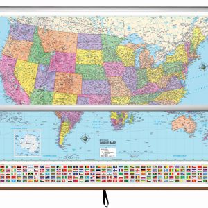
Map Order1. United States2. World Hanging hardware will be included with your map to ensure you have all the pieces to install once you receive your order! The Advanced Political Wall Map series by Kappa Map Group is an exceptional educational resource tailored for grades 9-12, providing a comprehensive exploration of global political landscapes. These…
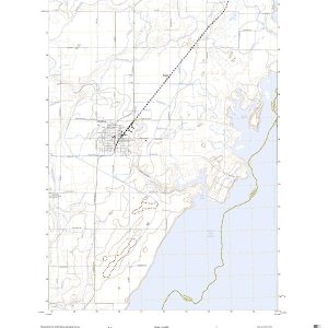
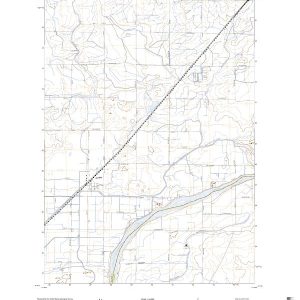
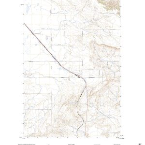
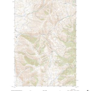
This is the current USGS topographic map for this quadrangle. Printed on waterproof, crease resistant paper, using HP fade resistant inks, this map comes rolled and shipped in a sturdy carboard tube. The map contains contour data, water features, roads and other features. Scale is 1:24,000. Printed size is 24 W x 29 H
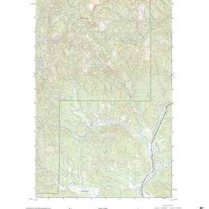
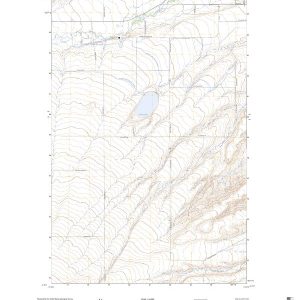
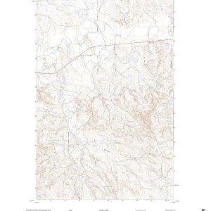
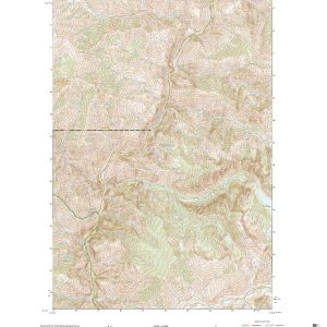
This is the current USGS topographic map for this quadrangle. Printed on waterproof, crease resistant paper, using HP fade resistant inks, this map comes rolled and shipped in a sturdy carboard tube. The map contains contour data, water features, roads and other features. Scale is 1:24,000. Printed size is 24 W x 29 H
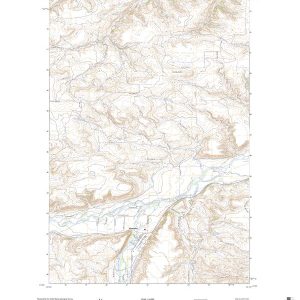
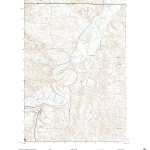
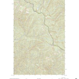
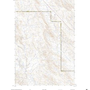
This is the current USGS topographic map for this quadrangle. Printed on waterproof, crease resistant paper, using HP fade resistant inks, this map comes rolled and shipped in a sturdy carboard tube. The map contains contour data, water features, roads and other features. Scale is 1:24,000. Printed size is 24 W x 29 H
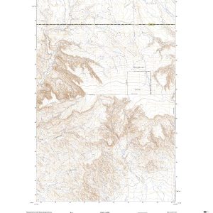
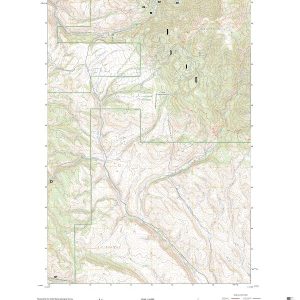
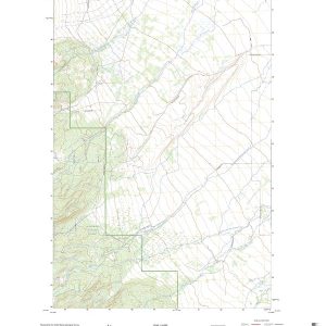
This is the current USGS topographic map for this quadrangle. Printed on waterproof, crease resistant paper, using HP fade resistant inks, this map comes rolled and shipped in a sturdy carboard tube. The map contains contour data, water features, roads and other features. Scale is 1:24,000. Printed size is 24 W x 29 H
This is the current USGS topographic map for this quadrangle. Printed on waterproof, crease resistant paper, using HP fade resistant inks, this map comes rolled and shipped in a sturdy carboard tube. The map contains contour data, water features, roads and other features. Scale is 1:24,000. Printed size is 24 W x 29 H
This is the current USGS topographic map for this quadrangle. Printed on waterproof, crease resistant paper, using HP fade resistant inks, this map comes rolled and shipped in a sturdy carboard tube. The map contains contour data, water features, roads and other features. Scale is 1:24,000. Printed size is 24 W x 29 H
This is the current USGS topographic map for this quadrangle. Printed on waterproof, crease resistant paper, using HP fade resistant inks, this map comes rolled and shipped in a sturdy carboard tube. The map contains contour data, water features, roads and other features. Scale is 1:24,000. Printed size is 24 W x 29 H
This is the current USGS topographic map for this quadrangle. Printed on waterproof, crease resistant paper, using HP fade resistant inks, this map comes rolled and shipped in a sturdy carboard tube. The map contains contour data, water features, roads and other features. Scale is 1:24,000. Printed size is 24 W x 29 H
This is the current USGS topographic map for this quadrangle. Printed on waterproof, crease resistant paper, using HP fade resistant inks, this map comes rolled and shipped in a sturdy carboard tube. The map contains contour data, water features, roads and other features. Scale is 1:24,000. Printed size is 24 W x 29 H
This is the current USGS topographic map for this quadrangle. Printed on waterproof, crease resistant paper, using HP fade resistant inks, this map comes rolled and shipped in a sturdy carboard tube. The map contains contour data, water features, roads and other features. Scale is 1:24,000. Printed size is 24 W x 29 H
This is the current USGS topographic map for this quadrangle. Printed on waterproof, crease resistant paper, using HP fade resistant inks, this map comes rolled and shipped in a sturdy carboard tube. The map contains contour data, water features, roads and other features. Scale is 1:24,000. Printed size is 24 W x 29 H
This is the current USGS topographic map for this quadrangle. Printed on waterproof, crease resistant paper, using HP fade resistant inks, this map comes rolled and shipped in a sturdy carboard tube. The map contains contour data, water features, roads and other features. Scale is 1:24,000. Printed size is 24 W x 29 H
This is the current USGS topographic map for this quadrangle. Printed on waterproof, crease resistant paper, using HP fade resistant inks, this map comes rolled and shipped in a sturdy carboard tube. The map contains contour data, water features, roads and other features. Scale is 1:24,000. Printed size is 24 W x 29 H
This is the current USGS topographic map for this quadrangle. Printed on waterproof, crease resistant paper, using HP fade resistant inks, this map comes rolled and shipped in a sturdy carboard tube. The map contains contour data, water features, roads and other features. Scale is 1:24,000. Printed size is 24 W x 29 H
This is the current USGS topographic map for this quadrangle. Printed on waterproof, crease resistant paper, using HP fade resistant inks, this map comes rolled and shipped in a sturdy carboard tube. The map contains contour data, water features, roads and other features. Scale is 1:24,000. Printed size is 24 W x 29 H